INTIMATE DETAILS

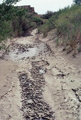
Road to Pueblo Bonito, Chaco Canyon National Cultural Park
Chaco Canyon was a center for the Anasazi civilization between roughly 900 and 1150 AD. Seven large pueblos were constructed and ninety-foot wide roads stretched in all directions. By the late 1970's almost every type of non-sustainable energy development was being proposed for the area around Chaco Canyon from mining for coal, oil shale, natural gas and uranium mining to the construction of a series of huge high emission coal-fired power plants.
I was invited by the National Park Service to come to Chaco to make a project that would give visitors a sense of the ecological dynamics and how they might change due to proposed energy development. I chose to focus on the relationship between the principal physical environmental factors— sunlight, wind and rain, and the principal physical form —sculpted earth, be it ruin walls, cliff faces or arroyo beds. For three weeks in late fall and another three weeks in the summer, I marked small areas in the earth and recorded the daily changes photographically. The results were compiled in a multi-image slide lecture/performance that was presented at the park as a campfire talk, as a slide/sound package that was sent to neighboring communities and was shown in part to the Department of the Interior, and as a performance and small photographic installation at New Langton Arts in San Francisco. Through a conflation of time and scale, the work communicates the elaborate canyon building process. After sharing the intimacy of spending three weeks in the canyon learning from its secrets, I tell of my shock as I climbed up a ridge and saw the haze from the huge coal-fired power plant in the distance. Archeologists still debate the nature of the catastrophic events caused the Anasazi to abandon Chaco over 800 years ago, whether they were caused by human action, environmental changes, or both. What can we learn from the haze in the distance?
Today archeologists marvel that an ephemeral arroyo could have supported a civilization of thousands of people.
Look closely. Watch carefully.
See how the mud cracks. The ant burrow. The sand banks crumble. A bit of mortar chips off a ruin wall. Shadows move during the course of the day.
Below are a few images from much more lengthy sequences. Many images are available also as black and white prints.
September 4, 1980
August 31, 1980
November 7, 1979

ruin wall
Light through a doorway during the course of a day
September 6, 1980
September 7, 1980
November 10, 1979
August 29, 1980
Pueblo Bonito November 1979
September 12, 1980
September 10, 1980
September 13, 1980

September 13, 1980
September 13, 1980